Moreton Island is located within Moreton Bay, off the coast of Brisbane in Queensland, Australia. The island covers an area of about 186 square kilometres and is recognised as one of the larger sand islands in the world, with most of its land over 98 per cent kept under national park protection.
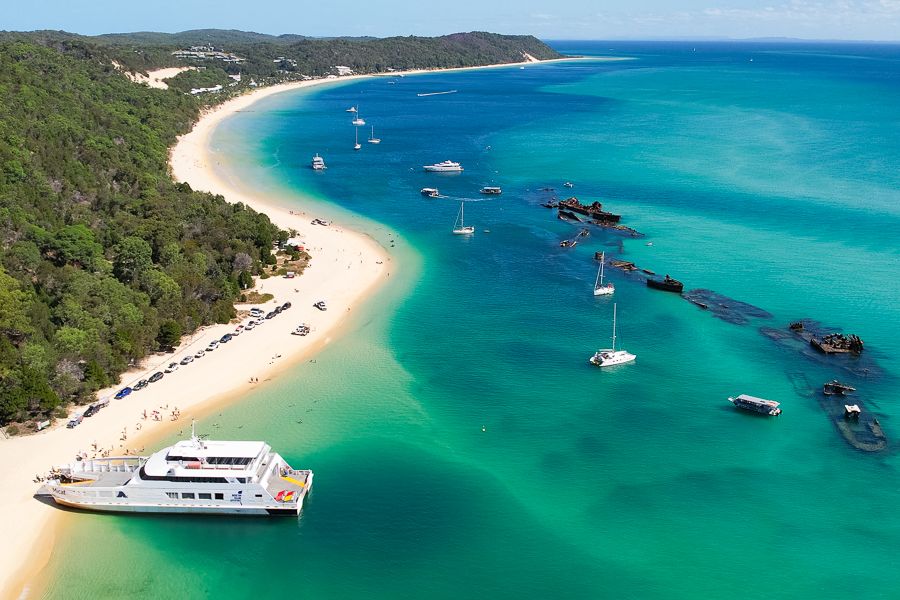
In comparison with more developed beaches in Queensland, this place remains largely undeveloped, with no sealed roads, very limited permanent population, and absence of large buildings, which gives it a more remote and less disturbed character despite its relatively short ferry distance from the mainland. The coastline consists of white sand and clear turquoise water, and features such as the Tangalooma shipwrecks and dolphin feeding areas are also present.
The island is considered suitable for families who look for relatively safe swimming areas along with 4WD driving opportunities, as well as for those interested in natural surroundings including dunes and wildlife. Couples may prefer it for quieter beach stays or camping conditions, while the visitors seeking activity may take part in snorkelling, sand tobogganing, or kayaking. It is also visited by people on short trips or overnight stays, as it provides a perfect mix of simple recreation and outdoor activity within a protected environment.
What Makes This Beach Unique
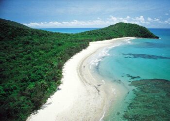
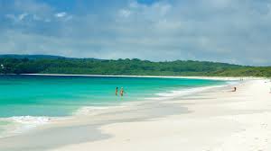
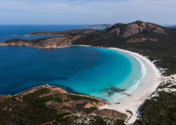
The beaches of Moreton Island are characterised by fine white quartz sand, which feels soft and powder-like underfoot and usually remains relatively cool even in warmer weather. The water is generally very clear, showing some shades of turquoise, and in many areas the sandy bottom and nearby reef formations can be seen without difficulty. Conditions differ across the island, with the western side having calmer waters, while the eastern side faces the open ocean and receives more regular waves, though often still manageable for less experienced swimmers.
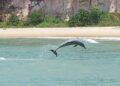
The natural setting includes large sand dunes, areas with submerged shipwreck structures suitable for snorkelling, and long open stretches of shoreline without major construction. There are no cliffs or built developments along most parts, only natural vegetation such as bushland and mangroves behind the beaches. As the island is formed entirely from the accumulated sand deposits, its landscape has quite a distinct character. The presence of wild dolphins in surrounding waters also contributes to an environment that remains largely undisturbed when compared to more developed coastal regions there.
Things to Do
Swimming in the clearer and generally calm water is often regarded as a primary activity, particularly around the Tangalooma area where conditions are more manageable. Some sections allow easier entry, though the situation may change with tides and weather. Snorkelling is carried out near the wreck formations, where small marine life is usually visible and the remains of old vessels have formed reef-like structures. Kayaking and paddleboarding are also seen in these calmer parts, while on land, activities such as driving on sand tracks with 4WD vehicles and sliding down dunes are commonly done.
Photography is practiced in many parts of the island, as the landscape includes shipwrecks, dunes, vegetation, and occasional wildlife. Movement across the island may be done by walking or by vehicle, using marked tracks, which allows a gradual observation of the surroundings. Certain areas are comparatively less visited, resulting in a quieter surrounding and a bit more undisturbed environment.
Activities of a calmer nature, such as sitting quietly, meditation or light stretching, may be carried out along the shorelines or in the shaded locations. Food-related facilities are limited and are mainly found near the resort section, although a few designated picnic areas are available for visitors. Other possible activities include watching dolphin feeding during evening time, sandboarding on selected dune slopes, fishing where it is permitted, and walking along short trails that lead to elevated points like Mount Tempest, which is regarded as one of the higher coastal sand formations. The availability and ease of these activities may quite vary, as they depend on weather conditions and other local factors.
Best Time to Visit
A more suitable period for visiting is generally during spring (September to November) or autumn (March to May), when temperatures are often between the mid-20s and low 30s °C. During these months, humidity tends to be lower and rainfall occurs less frequently, which makes beach use and snorkelling more comfortable. Weather conditions are mostly sunny and mild, allowing outdoor activities without the stronger heat that is experienced in peak summer.
Visitor numbers usually increase during school holiday periods and on summer weekends, although the overall size of the island allows it to still feel relatively open and less congested. In winter, water temperatures become cooler, but there are chances for observing whales offshore. At the same time, visitor numbers are lower and ferry costs may also be reduced compared to busier seasons.
Travel Tips & Safety
Lifeguard presence is generally not available on most sections of the beaches, therefore swimming should be done carefully and within personal limits. Water movement near the wreck areas may become stronger at times, so extra attention is required. During warmer months, marine stingers can be present, and use of protective clothing is usually advised. Clean conditions are maintained under national park regulations and the practice of leave no trace is followed.
Visitors are advised to carry reef safe sunscreen, hats, insect repellent, reusable water bottles, some food items and a bag for waste. Ferry bookings and 4WD access permits are better to be arranged in advance, as availability may not always be certain.
It is also necessary to check weather and tide conditions before travel, since rough sea conditions can sometimes interrupt transport services. Wildlife should be treated with care, and feeding of animals is generally not permitted except in organised and controlled situations.

