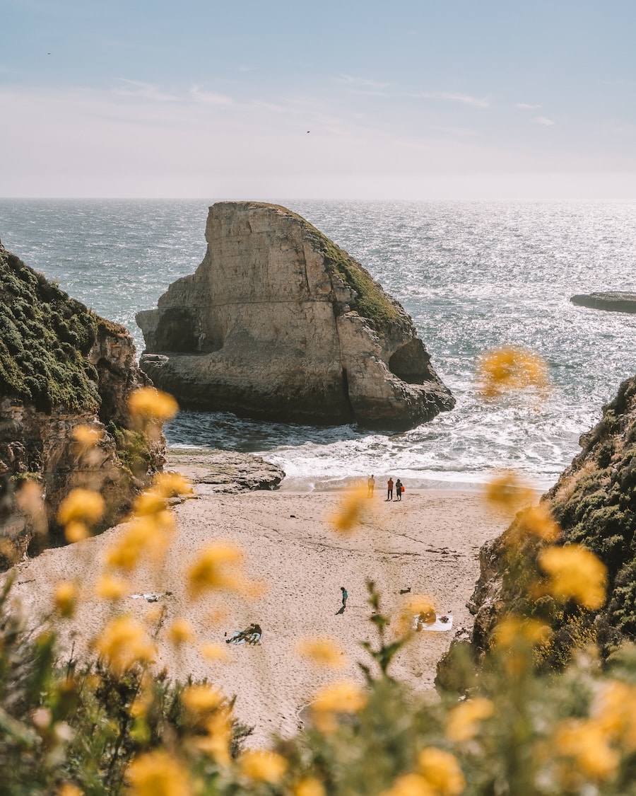
Shark Fin Cove is a narrow coastal inlet near the small town of Davenport, within Santa Cruz County, on the central coast of California. It lies roughly ten miles north of Santa Cruz, just off Highway 1.
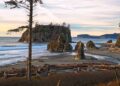
The beach is known for a tall offshore rock that rises sharply from the water and has a shape similar to a shark’s fin. The shore itself is made up of fine, light-colored sand, with a small sea cave and tide pools that have formed over time due to wind and constant wave action. The cove opens directly toward the Pacific Ocean, where waves are often strong and currents can be unpredictable, so the area is better suited for walking, observing, and photography rather than swimming.
Shark Fin Cove is part of Coastal Dairies State Park and is managed by California State Parks. Management includes maintaining access trails and protecting sensitive coastal features, such as tide pools and eroding cliffs.
Because it is less developed and slightly hidden from the road, the cove tends to attract photographers, hikers, and visitors who prefer quieter coastal locations. Its position along the Pacific Coast route also makes it a common short stop for people traveling through Northern California’s shoreline, even though the beach itself remains relatively uncrowded most of the time.
Fun Fact About Shark Fin Cove
The cove takes its name from a large offshore rock that rises sharply from the sea and closely resembles the dorsal fin of a shark. This natural formation has become a well-known visual marker of the area and is often photographed because of its strong outline against the ocean.
Owing to its coastal position and comparatively low levels of nearby artificial light, the site is also considered suitable for night sky observation. On clear evenings, it is possible to view and photograph stars, and at times the Milky Way can be seen, making the location of interest to those engaged in basic astronomical or long-exposure photography, though conditions are not always consistent.
Things to Do at Shark Fin Cove
Shark Fin Cove supports a limited range of quiet, observation-based activities that align with its exposed coastal character and undeveloped setting. The area is not designed for any intensive recreation, but rather for some careful exploration and appreciation of natural features.
Visitors often begin by walking down the narrow and fairly steep access path from the roadside parking area. This short descent already offers wide views of the cove, the open Pacific, and the prominent fin-shaped rock, though footing can feel uneven in places, especially after rain.
Along the shoreline, slow beachcombing is common. Small pieces of sea glass, shells, and the weather shaped stones may be found scattered along the sand, though quantities vary by season and recent wave activity. Some visitors spend time near the waterline simply observing wave patterns and coastal erosion.
At low tide, it may be possible to approach the sea cave and the remains of an old mining tunnel cut into the rock. These features should only be visited when tide levels are clearly safe, as rising water and wave surges can restrict exit paths without much warning.
Photography is one of the main reasons people stop here. The rock formation resembling a shark’s fin becomes especially defined during late afternoon or sunset, when side lighting creates strong contrast between rock, water, and sky. Cloud movement and mist sometimes add to the scene, though conditions are unpredictable.
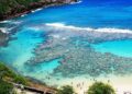
During calm low tide periods, tide pools form in the sheltered areas of the very cove. These pools may contain small marine organisms, offering a rare opportunity for quiet observation rather than close interaction. Care is usually taken not to disturb the pools or surrounding rock surfaces.
Some visitors choose to remain after dark for night sky viewing. Because nearby development is limited, artificial light is reduced compared to urban beaches, allowing basic stargazing or long-exposure night photography on clear nights, though wind and cold can make extended stays uncomfortable.
Short walks along the nearby bluffs or informal coastal paths provide additional viewpoints over the shoreline and surrounding cliffs, though these routes are not always clearly marked and should be followed with caution.
Swimming is generally avoided at this location. The surf is strong, water temperatures remain low throughout the year, and rip currents are common. As a result, the cove is quite better suited to passive activities such as walking, observing and photography rather than water entry.
How to Get to Shark Fin Cove
Access to Shark Fin Cove is by way of the coastal highway that runs through northern Santa Cruz County. The route is straightforward, though the final approach requires some attention.
From Santa Cruz, the drive usually takes around fifteen to twenty minutes. Travel north along Highway 1 for roughly ten miles, passing through the Davenport area. Traffic conditions and weather can affect timing slightly.
From San Francisco, the journey generally ranges between one and a half to two hours. The distance is close to seventy miles when following Highway 1 south. This route is scenic but slower than inland highways, especially on weekends.
Public transportation options are limited. Bus services operated by Santa Cruz Metro or Monterey–Salinas Transit reach the nearby town of Davenport, but schedules are infrequent. From there, visitors usually rely on a taxi or rideshare, which may not always be readily available.
Parking is informal and somewhat restricted. A small dirt pull-off is located on the west side of Highway 1, just north of Bonny Doon Beach. Parking is free, but spaces are few and can fill quickly on clear days. From the parking area, visitors must carefully cross the railroad tracks and then follow a steep footpath down to the cove.


