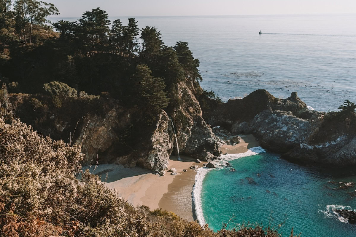
McWay Beach is a well-known coastal landmark situated within Julia Pfeiffer Burns State Park, in Big Sur area of Monterey County, California. It lies roughly 37 miles south of Carmel-by-the-Sea, along Highway 1. The beach itself is also a small pocket of sand, about 0.25 miles in length, located at the base of a steep coastal bluff.
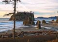
Its most distinctive feature is McWay Falls, an approximately 80-foot waterfall where McWay Creek drops directly onto the sand below, forming a rare meeting point between fresh water and the Pacific Ocean. High cliffs and thick coastal vegetation surround the cove, giving the area a naturally enclosed, amphitheater-like appearance.
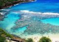
The site is managed by California State Parks as part of the larger state park system. Responsibilities include trail upkeep, visitor management, and environmental protection work such as habitat restoration and wildlife monitoring. McWay Beach is especially popular with hikers, photographers, and visitors interested in natural landscapes, and it is widely regarded as one of Big Sur’s most photographed locations.
Public access is limited to a short trail from the parking area above the cove. For safety and conservation reasons, entry onto the beach and swimming are not permitted. Its position along the Pacific Coast Highway makes it a frequent stopping point for travelers exploring the central California coastline.
Unique Feature of McWay Beach
The most notable aspect of McWay Beach is McWay Falls, a waterfall measuring roughly 80 feet in height that descends from a hanging valley to the shoreline below. Depending on tidal conditions, the falling water may land directly on the sand or flow into the adjacent sea. Such a waterfall reaching the beach is an uncommon natural occurrence and has led to this site being widely photographed along the California coast.
The waterfall can be observed from a designated overlook trail positioned above the cove, rather than from the shore itself. Together, the falling water, the enclosed nature of the cove and the surrounding redwood growth mixed with coastal scrub vegetation form a striking visual arrangement. This combination has, over time, established the location as one of the most recognizable landscape scenes of Big Sur, often associated with the region’s natural identity.
Things to Do at McWay Beach
One of the primary activities is viewing McWay Falls from maintained overlook trail. This elevated path offers wide views of the waterfall, the small cove below, and the open Pacific beyond. The trail from the parking area to the viewpoint is short, roughly half a mile round trip, and includes a section that is accessible for wheelchairs, making it suitable for visitors of different mobility levels.
Photography is a major reason people stop here. The contrast of falling freshwater, pale sand and deep blue ocean draws photographers throughout the day. Early morning and late evening are preferred by many, as the light at those times tends to soften the cliffs and create stronger shadows and reflections, though conditions can change quickly due to coastal fog.
From the overlook, visitors often spend their time watching marine life in the nearshore waters. Harbor seals and sea otters are sometimes visible resting or swimming close to the cove, especially during calmer sea conditions. Binoculars can be useful, as viewing is from a distance.
Picnicking is allowed only in designated areas near the parking lot or along approved sections of the trail. Open flames and fires are not permitted anywhere in this area, and visitors are expected to carry out all waste, as facilities are limited.
Many visitors combine a stop at McWay Beach with walks on nearby trails within the park. Options include forested routes such as the Ewoldsen Trail, which passes through redwood groves, or coastal paths like the Partington Cove Trail, offering additional views of the rugged shoreline.
It should be clearly noted that access to the beach below the cliffs is not allowed. All viewing and activities are confined to marked trails and overlooks, a rule that exists both to protect visitors from hazards and to preserve the sensitive coastal environment.
How to Reach McWay Beach
McWay Beach is accessed by traveling along Highway 1, which runs through the Big Sur coastline. Travel times can quite vary depending on the traffic, weather and road conditions, especially during peak seasons.
From Monterey city, the drive generally takes about quite 45 minutes to 1 hour, heading to the south on Highway 1 for roughly 37 miles. The route is scenic but narrow in several stretches, so driving speed is often slower than expected.
Visitors coming from San Francisco should allow approximately three to four hours by car, following Highway 1 south. While this route is longer than inland alternatives, it is commonly chosen for its coastal views, though delays are not unusual.
From Los Angeles, the journey usually takes between five and six hours. Most travelers follow US-101 north before connecting to Highway 1. Travel time may increase during weekends or due to landslide-related closures, which sometimes occur in this region.
Parking is provided at the entrance of Julia Pfeiffer Burns State Park. The standard day-use parking charge is generally about ten dollars per vehicle, and payment is accepted in cash as well as by card. The parking space available is limited in size and, during the summer period, it commonly fills by the late morning hours, therefore arriving early is usually advisable.
Public transport options are restricted. Service is provided by Monterey-Salinas Transit on routes operating from Monterey in the direction of Big Sur. Buses stop close to the park entrance, from where visitors are required to walk a short distance to access the trail leading toward the overlook. Bus frequency is not regular, and checking the timetable beforehand is necessary.


